
Roseville Neighbor Sources by Block
Roseville neighbors are best researched in layers. MapRamsey shows parcel boundaries, address points, and adjacent geometry. Beacon adds the tax-owner and mailing-address record. RecordEASE can help verify the recorded land instrument behind a parcel. MNVotes is limited to an exact registration confirmation, while a permitted voter-list request has separate rules. Block clubs and local organizations provide a contact route, not a public household directory. The result is a record trail around a block, not a claim about every person who may be there.
| Roseville block source | What it can show | How access works |
|---|---|---|
| MapRamsey parcels and addresses | Parcel boundaries, address points, adjoining geometry, selected attributes | Free public GIS with click, selection, buffer, and export tools. |
| Ramsey Beacon | Tax owner, mailing and situs address, parcel, value, and classification fields | Public property search; owner is not necessarily the occupant. |
| RecordEASE | Recorded parties, legal descriptions, deeds, and other instruments | Login, subscription, and image or document charges may apply. |
| MNVotes and permitted reports | Known-person registration confirmation; authorized street-sorted report | Free confirmation tool; full report requires statutory certification. |
| Block clubs and historical collections | Community contact route or historical neighborhood context | No public member roster located; repository restrictions can vary. |
Parcel data identifies land relationships, not social relationships. A tax owner may receive mail at another location, and a mapped address does not reveal every household member. Begin with the lot boundary and work outward one parcel at a time. For a complete named-street chain rather than the immediate block, the Roseville street directory follows the broader address-record path.
Roseville Neighbor Parcel at MapRamsey
MapRamsey accepts an address or parcel search and marks the result on the map. Turn on the Tax Parcels, Addresses, streets, and relevant subdivision or survey layers. At close zoom, the target boundary and adjoining boundaries become visible. The Identify tool opens details for a selected feature and provides the link from map geometry to additional parcel information. Record the ParcelID and situs address for each parcel before comparing any owner fields.
The MapRamsey schema includes owner-name, mailing-address, tax-name, tax-address, parcel, and join-date fields. It does not expose a resident roster, date of birth, phone number, voter status, utility customer, or full household list. That makes it useful for defining the physical block around Roseville neighbors, but it does not answer who is currently present behind each mapped address.
MapRamsey’s operational-layer legend shows the public map layers that support parcel and address work.
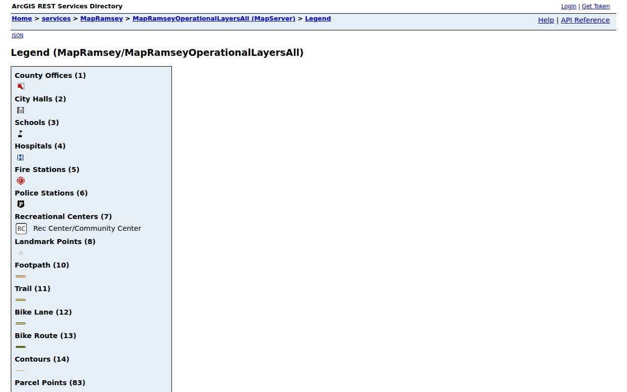
Use the layer list to choose only the geography needed for the immediate Roseville block, then verify each owner field through the linked county record.
Roseville Block Selection for Neighbors
For more than one adjoining lot, MapRamsey’s selectable Tax Parcels and Addresses layers support click, rectangle, or spatial selection. An optional buffer or search distance feeds the Apply command and then Results. Results can be removed, saved to My Content, exported as a feature-collection JSON file, or exported as CSV. The attribute table has a separate export path with record count, selected-record, hidden-column, and expression-filter controls. Keeping those two export paths straight avoids mistaking a map selection for a full data extract.
This local workflow is most useful after the target parcel has been identified. A map result provides the block geography. Next, compare each parcel in Ramsey Beacon, then use RecordEASE when the question is about a recorded owner or legal description. The GIS map alone cannot establish shared ownership or a personal connection among neighbors.
Note: MapRamsey has separate Results and attribute-table exports, so record which tool produced a Roseville block file before comparing fields.
Roseville Voter Reports for Neighbors
MNVotes is designed for a known person and address. It does not browse a block. Minnesota does offer authorized reports that can include a street-sorted walking list or one-per-household labels, but that route requires the requester to be a registered Minnesota voter and to certify a permitted use. The report cannot be posted online as a searchable public database. Minnesota does not register voters by party, and voting history does not reveal ballot choices.
The contrast matters. An exact MNVotes confirmation is a free, narrow check. A full report is regulated by Minn. Stat. §201.091, may carry a reproduction charge, and uses a formal request process. Protected voters and Safe at Home participants are not ordinary block-visible records. Do not attempt to infer a missing person from the names on nearby parcels or from an authorized report’s gaps.
Ramsey County’s election-map resources provide address-based precinct, ward, and district context rather than a neighbor roster.
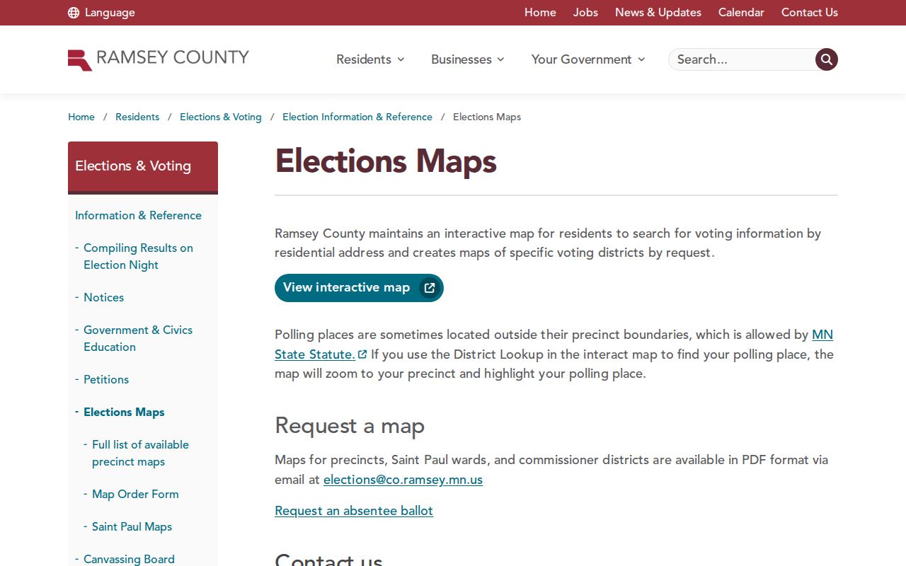
Election geography can explain which district serves an address, but it should not be used to reconstruct protected or unlisted personal information.
Roseville Neighborhood Block Clubs
Roseville reports approximately 145 active neighborhood block-club groups. The city offers a contact and joining route, but the reviewed materials did not locate a public member directory. Its community-organizations listing includes the Roseville Central Park Foundation, Friends of Roseville Parks, Friends of OVAL, Roseville Historical Society, and youth or community groups. These are useful ways to find an organization’s public contact, not a substitute for an address-based record.
Neighborhood Block Clubs
Citywide groups with a city contact route. Public member rosters were not located.
Roseville Block Clubs
Community Organizations
Public listings for civic and nonprofit groups, with organization rather than household information.
Roseville Community Organizations
Roseville Historical Society
Public research hours and local historical resources, not a current resident register.
Roseville’s Neighborhood Block Clubs page is shown below with the city’s official community contact route.
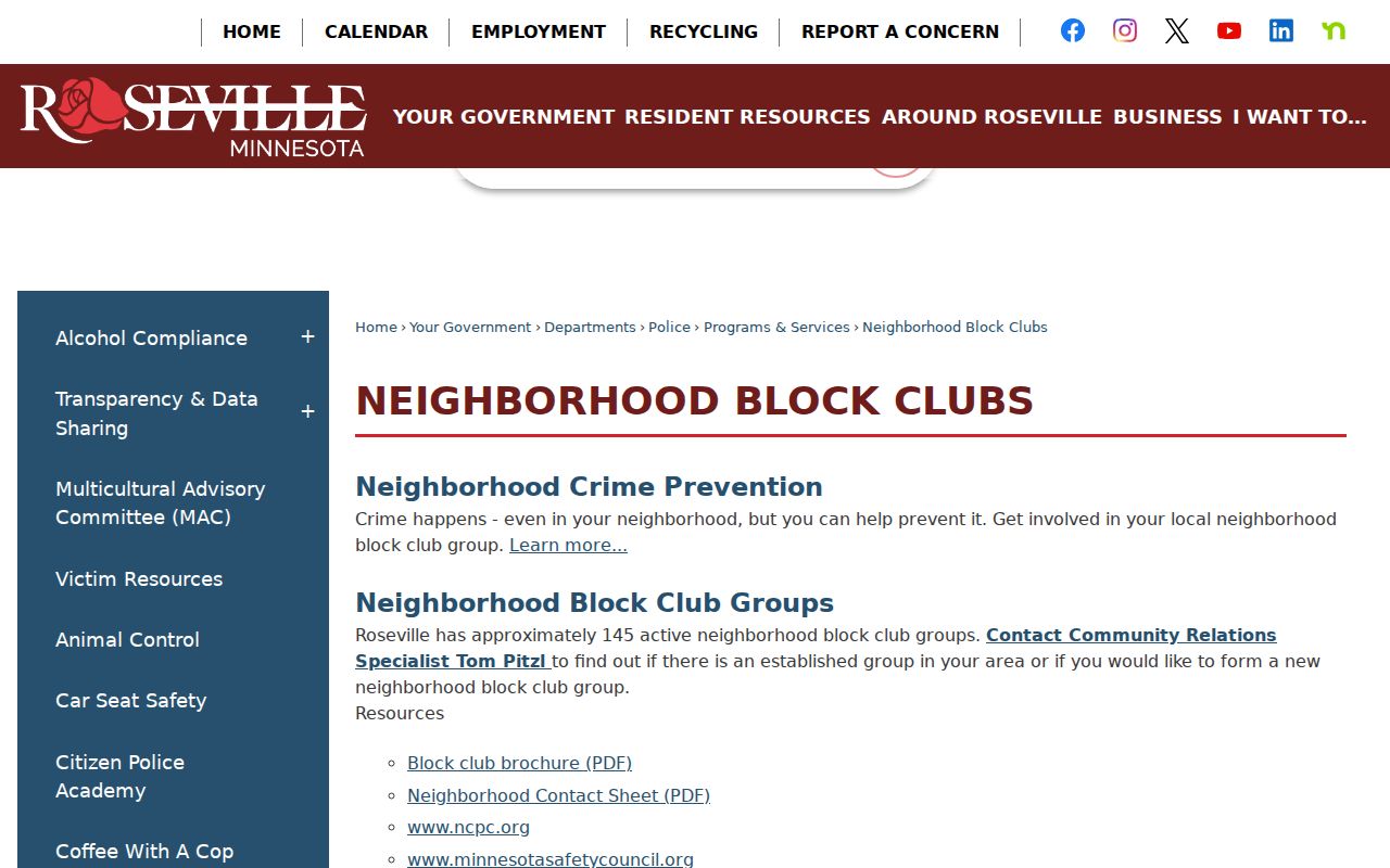
The block-club route supports a respectful community connection without claiming that club participation identifies every Roseville neighbor.
Roseville’s community-organizations listing shows the public organization layer available around local neighborhoods.
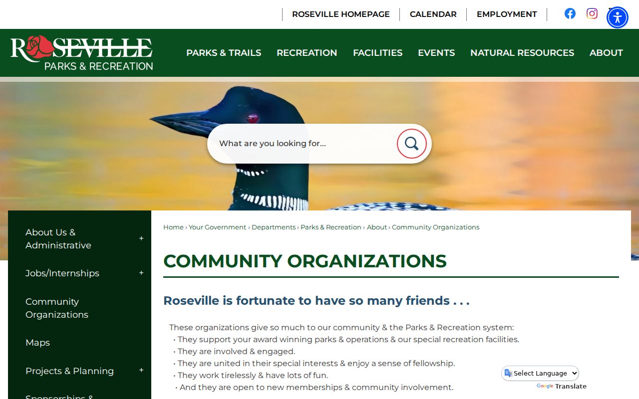
Use those public listings to reach an organization, while respecting that its members are not a public block directory.
Roseville History Trails for Neighbors
Historical sources can add context to a block without making claims about a current occupant. The Ramsey County Historical Society finding aids identify Roseville and Rose Township material, including neighborhood, church, school, veterans’ organization, and family collections. Some historical membership directories occur in those collections, but access can depend on the finding aid, repository location, donor terms, and privacy restrictions. A historical name should remain tied to its date and record type.
The Minnesota Genealogical Society Ramsey Cemetery Project can supply cemetery geography and interment metadata for Roselawn, Sunset, and other Ramsey sites. Cross-check any family or death lead with a cemetery office, obituary, probate docket, or other custodian record. Roseville Historical Society members also preserved local material, including early cemetery records and newspapers, which can make a gap in a digital map a cue to check local collections.
The Ramsey Cemetery Project is shown below as a historical lead rather than a current neighbor search.
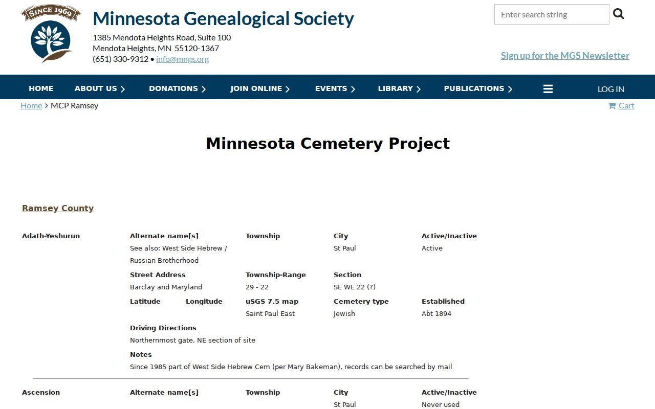
Cemetery metadata may help confirm an older family connection to Roseville, but it cannot establish who is now at a nearby address.
Map a Roseville Block and Verify Owners
Keep the workflow focused on the immediate surroundings of one address. The map defines which lots touch the target. Beacon supplies the current tax-owner view. RecordEASE supplies the recorded-document trail when a legal ownership question remains. That sequence preserves the distinction between adjacent parcel geometry, tax information, and recorded title data. It also leaves a clear route back to the custodian when an older record is not online.
- Search the target address in MapRamsey, enable Tax Parcels and Addresses, and use Identify on the target parcel.
- Click each adjoining boundary and record the ParcelID, situs address, and linked parcel detail without publishing sensitive fields.
- Use rectangle or spatial selection with an optional buffer only when a small block set is needed, then document whether Results or the attribute table supplied the export.
- Check each parcel independently in Beacon, then use RecordEASE for a deed, legal-description, or instrument question.
A streetwide review needs a different workflow. The Roseville street directory covers the full named-street record chain, while this neighbor method stays with the parcels immediately around the address.
Private Data Limits for Roseville Neighbors
Parcel, GIS, and historic sources leave out much of what should remain private. They do not create a public record of every household member, utility account, unlisted phone, protected voter, or Safe at Home physical address. An owner mailing field is not proof of occupancy. The Safe at Home program uses a designated address for eligible participants while securing the physical address. A missing item can therefore be intentional and protected.
Under the Minnesota Government Data Practices Act, government data are public only unless another law classifies them otherwise. Commercial neighbor tools are compiled listings with possible stale matches and unclear sourcing. Official parcel, court, or election records each have narrower but knowable limits, and the custodian is the proper source for a correction. Do not combine same-name records or a map result into an unsupported claim about a person.
| Official record route | Commercial neighbor category | Practical difference |
|---|---|---|
| Custodian identifies the record type, date, and access rule. | Compiled listings can blend public and marketing data. | Verify the official source before relying on a name or address. |
| Map and parcel data show defined fields and boundaries. | A list may not show its source date or match logic. | Do not treat a compilation as proof of occupancy or identity. |
Lawful use. Use information about Roseville neighbors for personal, lawful purposes and never to monitor, threaten, harass, or intimidate another person. Minnesota’s harassment and stalking law limits repeated harmful conduct.