
Start a Roseville Street Directory Search at the Parcel
For a named Roseville street, begin with the property address in Ramsey County Beacon. The result can separate the situs address from owner names, the owner mailing address, the parcel number or PIN, and the legal description. Copy those identifiers before moving on. A trust, estate, or business may appear as owner, and the mailing field can lead outside Roseville, so neither field alone establishes who occupies the address.
- Use Beacon regular or Advanced Address Search to find the situs address, owner field, PIN, and legal description.
- Open the same address in MapRamsey, turn on Tax Parcels and Addresses, and use Identify to reach the parcel detail.
- Take the owner name and legal description to RecordEASE for the recorded-document trail.
- Use MNVotes only to confirm a known person and address, or use its restricted request route when statutory conditions apply.
- For an older address, compare reverse directories and historic maps with the parcel description rather than assuming a modern street label has always matched.
This sequence keeps a street-by-street inquiry anchored in the public sources that actually index addresses. It also preserves the stable PIN and legal-description clues needed when a parcel has been divided or an older source uses Rose Township instead of Roseville.
Roseville Street Directory Clues in Ramsey Beacon
The Ramsey County Beacon property search is the first address-oriented source because its official guide documents regular, advanced-address, PIN, and plat/block/lot routes. Advanced results can reach 2,000 entries, and the guide also describes selectable map results, configurable columns, Excel downloads, and Address Labels 5160 exports. Those functions expose parcel and owner information, not a roster of everyone who may be at an address.
| Beacon control | Street use | Result to save |
|---|---|---|
| Advanced Address Search | Filters a group of property addresses, with a documented 2,000-result maximum. | Situs-address rows for the segment. |
| Address or Map | Locates one property, then opens the map workflow. | Property address and owner-name row. |
| Parcel Number / PIN | Returns the parcel when a street number is unclear. | Stable parcel identifier. |
| Plat / Block / Lot | Uses the subdivision description found in a deed or map. | Legal-area match. |
| Columns and Download | Customizes results and exports Excel or Address Labels 5160. | Result set for later checking. |
The official guide cautions by implication that a mailing-label export emphasizes owner name and mailing address. Keep that output separate from the situs address while building a Roseville street directory trail.
Map a Roseville Street Directory Segment in MapRamsey
MapRamsey's public manual documents an address-or-parcel search box, layers, attribute tables, spatial selection, optional buffers, and separate Results exports. Search a target address, then use a rectangle or other spatial selection for the segment. The Attribute Table can expose selected records, filters, field choices, and CSV export, while the Results panel can export CSV or a feature collection. The parcel link is the bridge back to county property details.
The MapRamsey Primary Addresses layer shows the address-source side of that workflow.
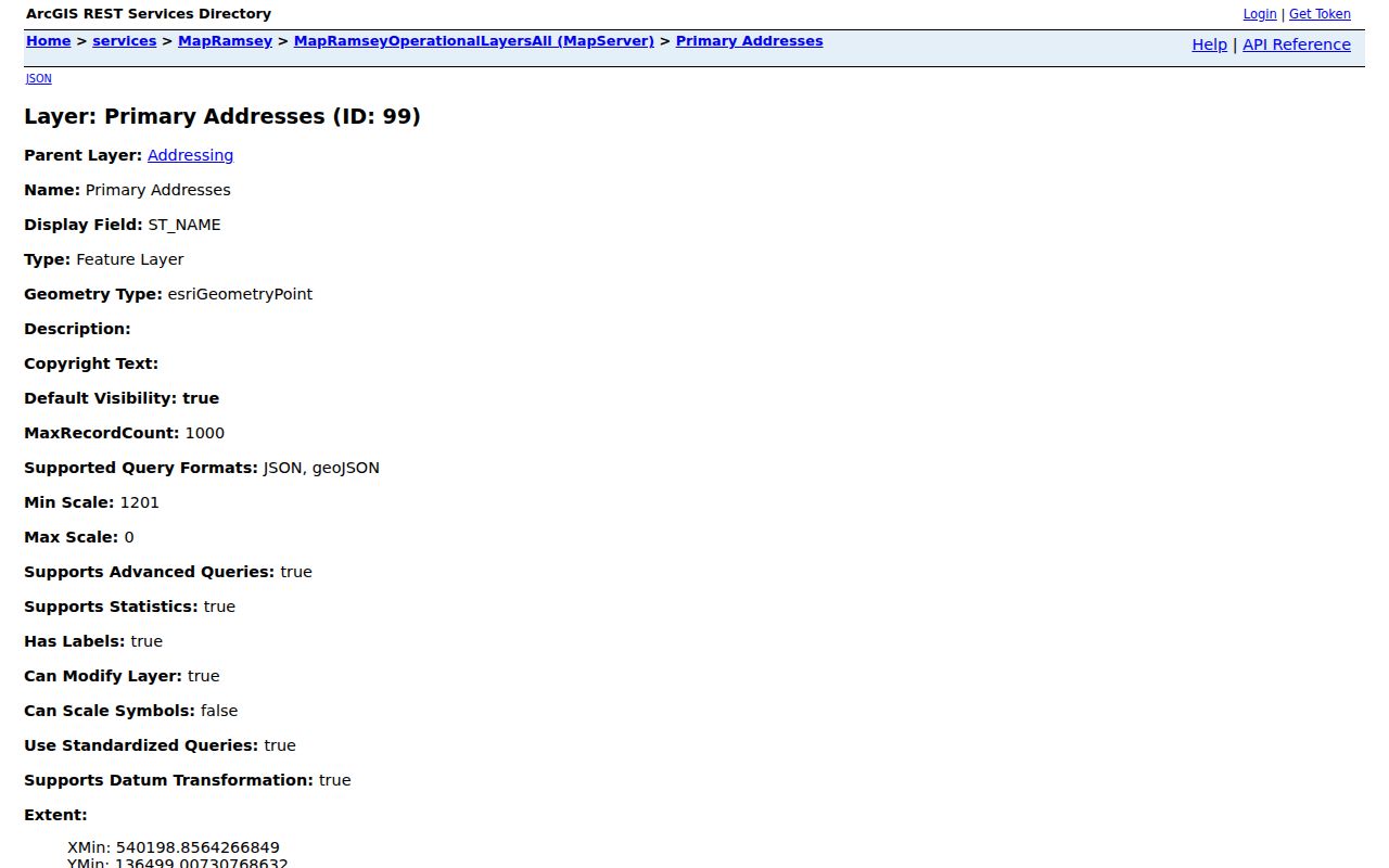
Address points can be selected and compared with the parcel layer, but an address point is still a location record rather than evidence of every person associated with that place.
The attributed tax-parcel layer shows the parcel-side field set, including ParcelID, owner-name fields, and owner or tax mailing fields.
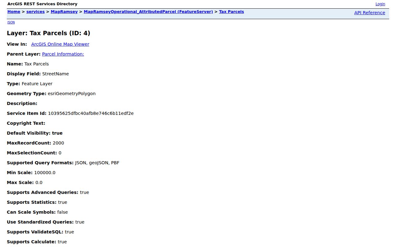
Use the parcel identifier to join map geometry to the assessor and recorder trail; the available mailing fields should never be recast as a complete resident list.
Roseville Street Directory Fields: Situs, Mailing, and Legal Description
A single property can carry several valid address-like clues. The situs address is the physical parcel location used by GIS, assessor, and permit records. The mailing address is the destination for tax or owner correspondence and can differ from the situs. The legal description is the recorded land identity used by deeds, plats, easements, and the title chain. When sources disagree, the legal description and PIN are the stronger cross-system match.
- Parcel or PIN
- The county identifier that connects Beacon, MapRamsey, Accela, and recorder research. Preserve its hyphens and leading zeroes exactly as shown.
- Situs address
- The physical location of a parcel. It is not automatically an owner's mailing location.
- Plat
- A recorded subdivision map that translates a street location into lots, blocks, and other legal land references.
- Criss-cross directory
- A reverse directory arranged by street and number, useful for historic address-to-occupant clues rather than current proof.
Note. A county owner-mailing field may be useful for correspondence research, but it is not proof that the named owner occupies the Roseville situs address.
Follow a Roseville Street Directory Lead Through RecordEASE
The Ramsey County recorded-documents access page leads to online and counter options. In RecordEASE, start with a current owner or legal description, find a recent deed, then search the earlier party as both grantor and grantee. A result can show land type, document number, recorded date and time, image availability, title-transfer indicator, document name, reference documents, parties, legal descriptions, and notes. Use a document marked “Transfers Title? Y” as a triage clue, then verify the full legal description.
The county's documented recorded-document access route is shown below.
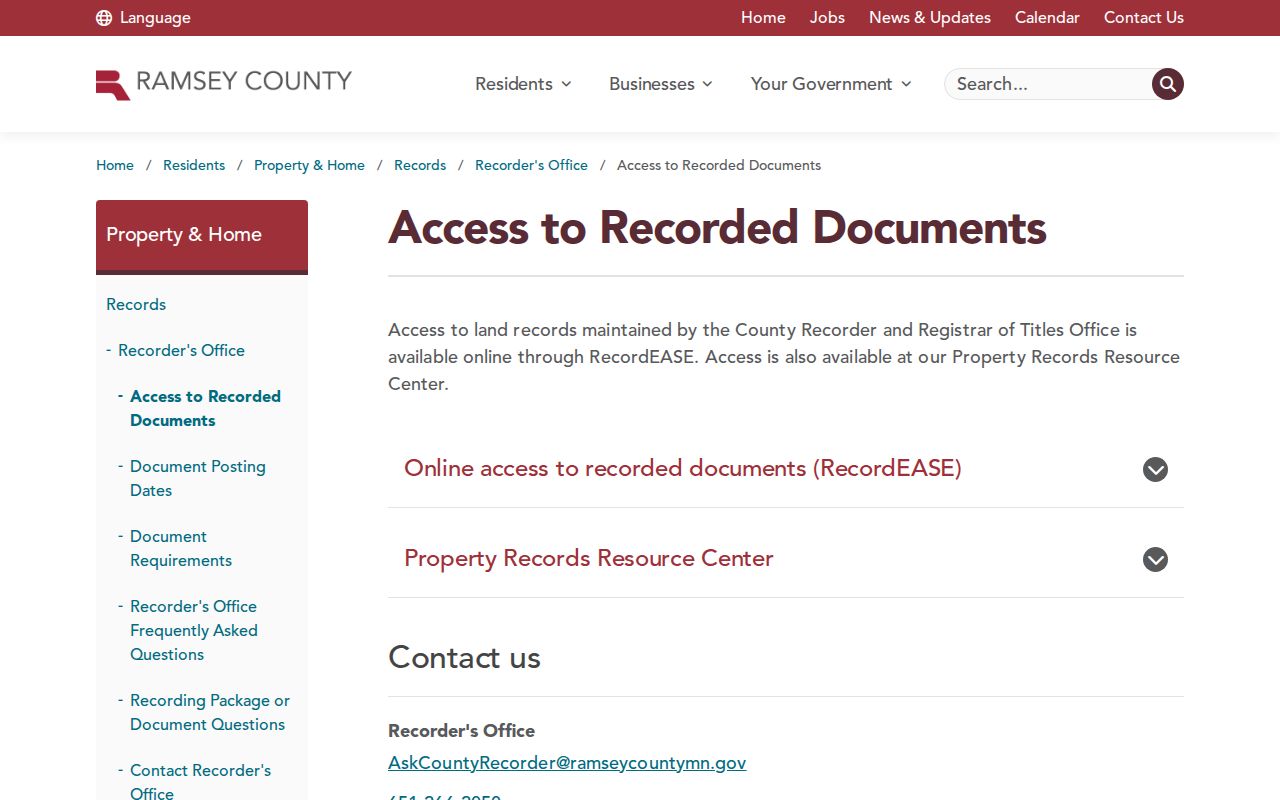
Electronic recording began April 24, 2014, but that is not a verified beginning date for every online index entry. When the online chain stops, the Recorder's consolidated index, microfilm, older deed and index books, the Property Records Resource Center, and the Minnesota Historical Society deed-book finding aid are the documented fallback path.
Roseville Street Directory Evidence From Permits and Maps
Address records can also describe changes to a property. Roseville's public Accela General Search accepts street number and street name, parcel, ZIP, contractor or business, dates, permit type, license, unit, city and state, and status. Issued, Closed, Finaled, and Expired results can date work at an address, but they do not establish a household. When a permit or address has changed, compare it with the city address atlas and the parcel's legal description.
The public Roseville permit search shows the available local address-search route.
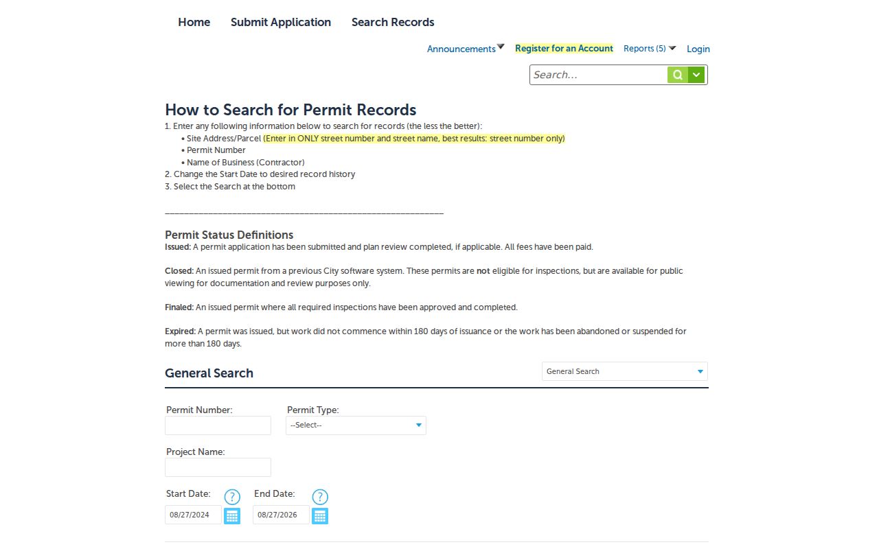
Permit dates can support a timeline for an addition, alteration, demolition, or other recorded work, while the parcel and deed sources remain the better places to test ownership continuity.
The Roseville City Address Atlas provides a city map viewer for checking the local street frame.
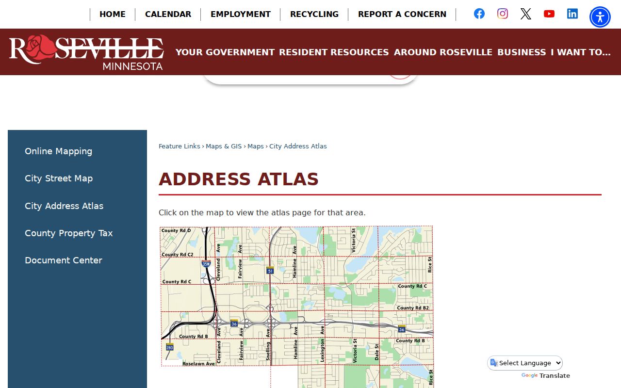
Its map context complements, rather than replaces, the county's address authority, parcel fields, and recorded legal descriptions.
Roseville Street Directory Research Across Older Place Names
Older results may be filed under Rose Township, Saint Paul, or adjacent place names. Rose Township began in 1850, Roseville incorporated as a village in May 1948, and it became a city in 1974. The city map collection includes historic 1848 plats and a 1931 farm-map overlay, which can help reconcile rural legal descriptions with present streets. No official year-specific Roseville readdressing project was located, so do not assume a missing old street number reflects a documented renumbering.
For historic occupancy clues, St. Paul directories from 1929 and later use street-then-number ordering, while earlier volumes can be street-only. Read nearby listings, advertisements, plat names, and landmarks alongside the legal description. The historical volumes themselves are covered in the Roseville Directory Book, leaving this street directory focused on the address trail.
Roseville's city GIS has used updated county base data since 1993. For older parcels, retain the historic map reference beside the modern address so another researcher can repeat the comparison.
Roseville Street Directory Records by Address
Each system answers a narrow question, which is why a reliable street search compares them instead of expecting one portal to prove every detail. Beacon and MapRamsey locate the parcel and tax owner. RecordEASE identifies recorded instruments. Accela dates public permit activity. A voter tool has tighter limits than an address search, and the city archives or a Chapter 13 request can be a fallback when a particular public record is not online.
| Address-keyed source | Keeper | What it can show | Access route |
|---|---|---|---|
| Property and tax parcel | Ramsey County Assessor / Beacon | Owner name, mailing and situs fields, PIN, classification, value where shown. | Public search and documented export modes. |
| Parcel and address geometry | MapRamsey | Address points, parcel boundaries, selected attributes, and parcel link. | Public viewer, Results export, or attribute-table export. |
| Recorded instruments | Ramsey Recorder / RecordEASE | Parties, document dates, legal descriptions, and instrument references. | Online account service; counter, resource center, books, and microfilm for gaps. |
| Building permits | City of Roseville Accela | Address or parcel-linked permit activity and status. | Public General Search; request a specific address and date range if needed. |
| City archives | Roseville Archive Center / Laserfiche | Public packets, minutes, ordinances, resolutions, elections materials, and oaths. | Search or browse by word, phrase, and meeting date. |
Roseville's Archive Center is another local access channel. Its current center holds recent public documents, while older material is searchable through Laserfiche. The city names affidavits of legal publications, council packets and minutes, ordinances, resolutions, commission packets and minutes, elections information, and oaths among its categories. Searching by word or phrase, or by a meeting date when the question concerns a public appearance, can add context to an address without turning those civic records into a household index.
Ramsey County accepts public-data requests through its Data Practices portal or in writing. Under the Minnesota Government Data Practices Act, public data can be inspected without charge, while copies follow the county schedule and the county does not have to create data that do not exist. A focused request should state the address, record category, and date range, particularly when the relevant code, permit, or archived file is not searchable online.
Roseville Street Directory Limits on Voter Evidence
MNVotes is a free confirmation tool for a known person and address. Its ZIP mode also requires the county, city or township, house number, street, and, when applicable, unit number. It is not an unrestricted way to browse a Roseville street. Minnesota's authorized voter-list route can provide a walking list sorted by street, but the requester must be a registered Minnesota voter, certify a permitted use under Minn. Stat. §201.091, and pay the stated report cost. Protected voters can have identifying information withheld.
That boundary matters: voter information may corroborate an already known address in the proper channel, but it should not be treated as a substitute for a public, open-ended street directory.
What the Roseville Street Directory Cannot Establish
Parcel data do not reveal every household member, short-term visitor, private utility customer, DMV address, unlisted telephone number, protected voter, or Safe at Home participant's physical location. The tax roll is an owner and mailing-address source, not an occupancy roll. A MapRamsey print-label option can produce address or primary-taxpayer labels, but that output also is not proof of household composition.
Lawful use. Use Roseville address records for careful, lawful personal research and civic or family-history questions. Minnesota law prohibits stalking, harassment, and intimidation, and a missing address can reflect a protected privacy program rather than an error.